Weather satellites and radars: essential for tracking clouds and their rain
• 2 min read
The return of rain isn't predicted solely by weather models. Today, technological means allow us to scrutinise the slightest signs of rain with unprecedented precision.
"Whoa, look at those big clouds... we're going to get a downpour!" Does that bring back memories? We've all tried to understand what those dark, sometimes very high, clouds in the sky meant. Better yet, to predict the arrival of rain, occasionally being surprised to see it moving in the opposite direction from where we were. Today, reliable and expert tools for monitoring rain and cloud movements are available on our phones or computers. You're probably familiar with them: weather satellites and precipitation radars.
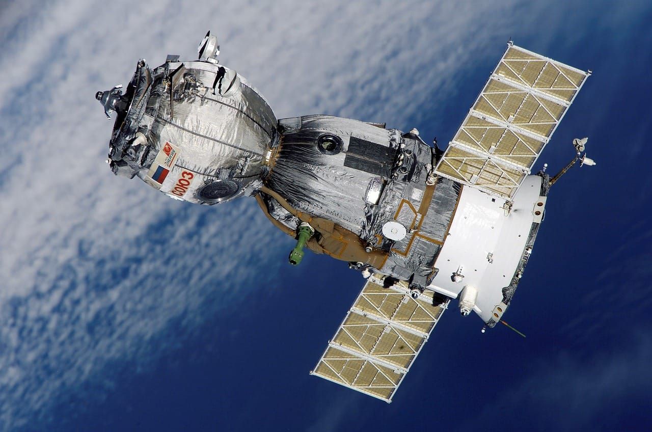
Satellites: to observe clouds from space
We could define them as the eyes of our Earth. Installed in orbit around our planet, weather satellites constantly photograph the millions of clouds that fly over our land every day. They are numerous and increasingly precise in observing our clouds. They are able to inform us about the shape and size of the clouds, about the temperature present at the tops of these monsters that sometimes reach 12 to 15 km above the ground. They are also able to know the quantity of water vapor present in the cloud and to carefully follow their movements and direction. During stormy degradations, we discover on the satellite animation what look like immense balls. They are synonymous with storm clouds, which are called cumulonimbus. It is at the top of these clouds that we find temperatures largely below zero, sometimes reaching -60, -65°C.
To help you become an observation pro, you should know that there are two main families of weather satellites :
Geostationary satellites: they remain fixed, always positioned above the same point, allowing the evolution of these clouds to be monitored in real time.
Polar satellites orbit the Earth from pole to pole, allowing them to capture precise and diverse measurements thanks to their wide coverage and constant movement (see end of article).
Precipitation radars: to see clouds from the inside
They are the complete opposite of the satellites we just discussed together. While satellites allow us to observe clouds from outside, weather radars allow us to learn more about the amount of precipitation inside our clouds. Radars are installed on the ground, and the reliability of this data depends on the systems installed and the coverage provided by these devices, which are essential for monitoring rain patterns. These radars send waves that bounce off the precipitation:
Precipitation intensity
Type of precipitation: rain, snow, sometimes hail
Location of precipitation
Movement of these precipitations
By tracking the movement of precipitation cells, it becomes possible to identify areas that are likely to be affected by rain or snowfall in the near future. During spring and summer, radar systems are especially valuable for monitoring storm activity and anticipating which regions may experience severe weather. On a rain radar map, more intense colors indicate heavier precipitation.
Weather satellites and rain radars, hand in hand
These technological gems are an integral part of short-term forecasting. The observation and analysis of all the data from these devices makes it possible to anticipate and specify a very short-term weather forecast with a high level of reliability. This is what is known in the weather world as "nowcasting," providing a forecast for the next few hours by combining satellite images, radar data (precipitation), and in some cases, artificial intelligence.
Twice a month, news on agricultural weather, ag-tech, and Sencrop innovations to enlighten you and help you make better decisions every day. Subscribe now! 👇