During the cereal harvest, an important data for farmers is the forecasting of rainfall particularly on a very short term.
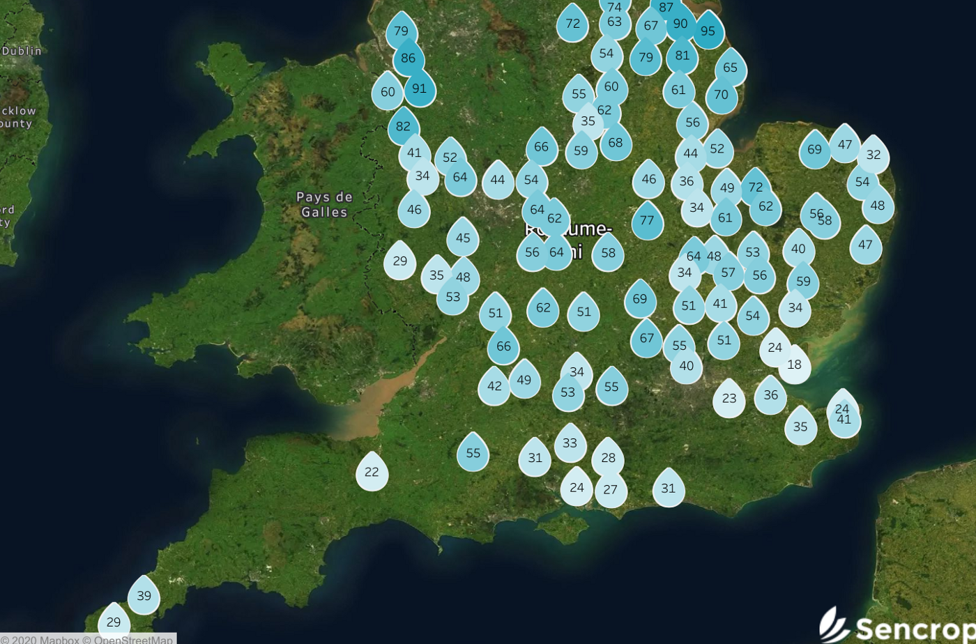
From a climatological point of view, July 2020 is characterised by a very marked weather gradient between northern and southern Europe. This contrast has its origin in the circulation of Atlantic lows. Indeed, Ireland and the United Kingdom are directly influenced by rain fronts ! While the British Island experiences a total rainfall amount close to the seasonal normal, the Mediterranean regions dry out under the sun’s rays. Nevertheless, the values from the weather stations in our network show a significant precipitation deficit in the UK since July 1st.
Indeed, the average total rainfall for July in London is around 50 millimetres (= litres per square meter). The majority of our rain gauges, Raincrop in this region have not recorded more than 20 to 30 millimetres. On the other hand, there are significant disparities from one region to another due to variations in the intensity of rain showers. If a farmer is busy harvesting, it is crucial for him or her to anticipate the arrival of weather conditions.
Given these local differences, keeping an eye on the rain radar offered by the Sencrop interface, allows farmers to better to apprehend the weather and improve the profitability of their activities.
Thanks to the Sencrop radar, which allows visualizing the movement of the zones of and downstream rainfall, operators can best optimize the rainfall and the organisation of their agricultural operations.
by Eglantine Vanhove
The Sencrop team
Share this article
A newsletter on weather and Ag-Tech
Twice a month, news on agricultural weather, ag-tech, and Sencrop innovations to enlighten you and help you make better decisions every day. Subscribe now! 👇