“Why do the weather forecasts not match my rain gauge readings? Why doesn’t the neighbouring farmer have the same rainfall records as me?”
Rainfall’s natural variability makes it difficult to calculate. Furthermore, environmental factors, such as wind or rain gauge location, affect its measurement. Many elements must therefore be taken into account when measuring rainfall to ensure the reliability of the data returned.
Back to basics, understanding rain
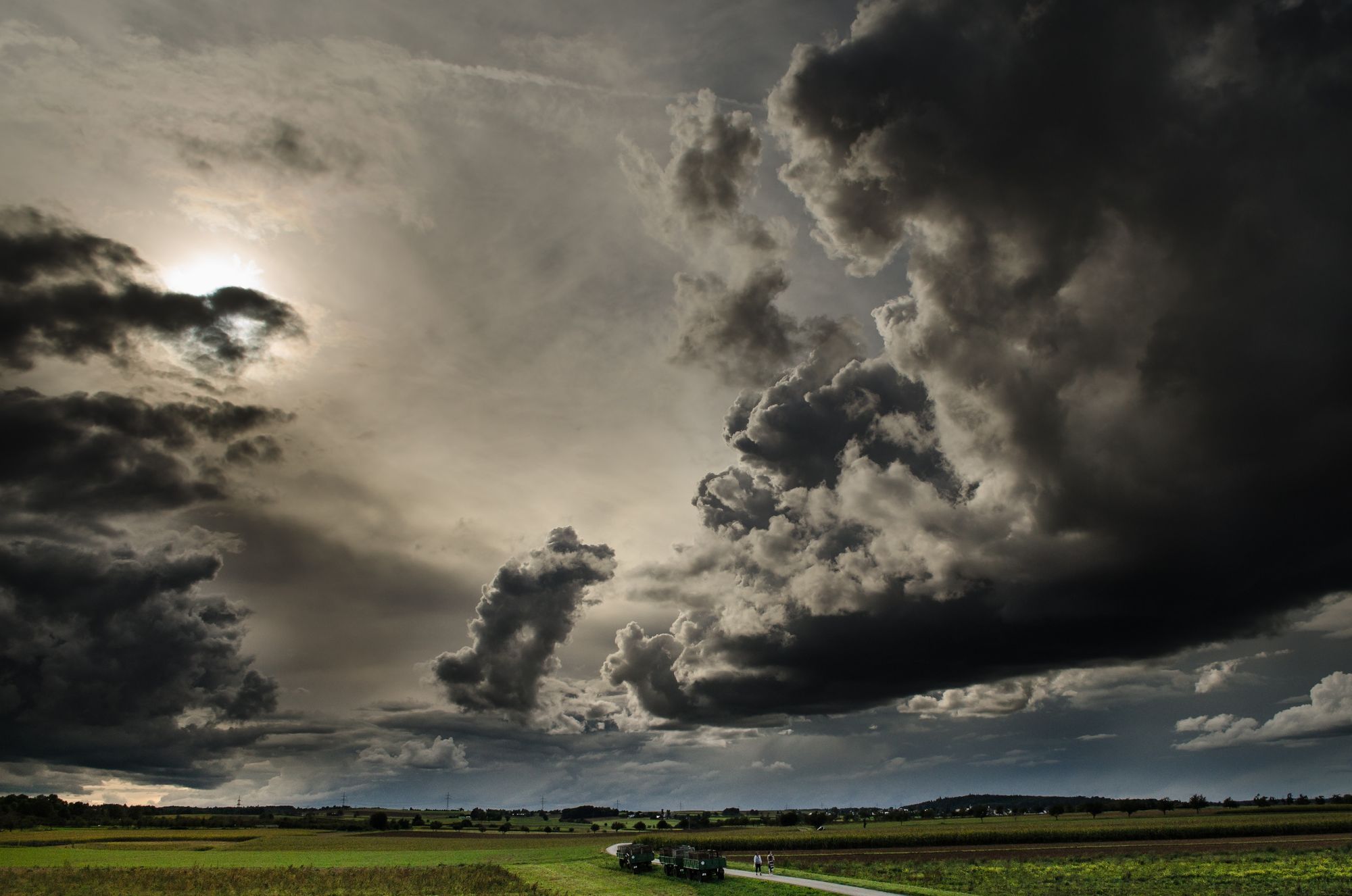
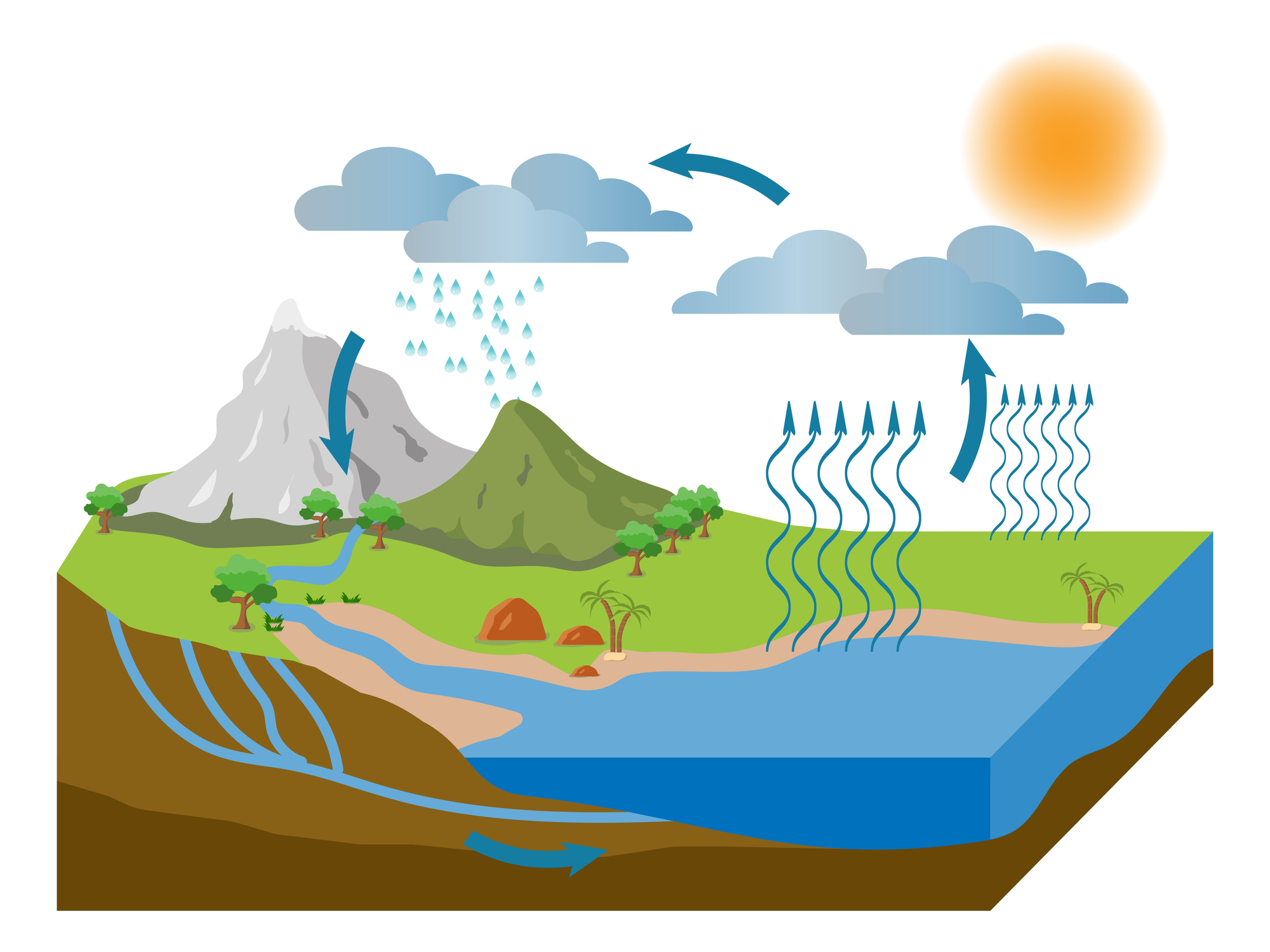
On paper, the water cycle is simple: water reserves evaporate, cool with altitude and condense to form clouds, mist or fog. When the cloud is saturated with water, the water falls back to the surface in various forms of precipitation.
Illustration of the water cycle
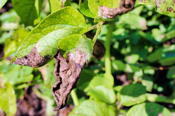
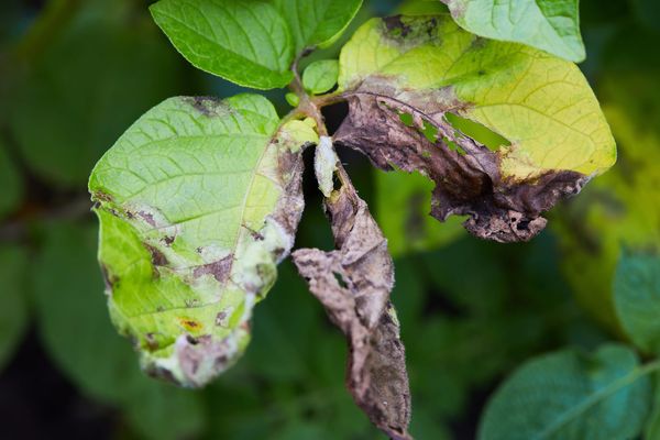
Rainfall is critical weather information for all agricultural professionals. It considerably influences the growth of crops and therefore yields. However, rain and humidity can contribute to the risk of developing diseases such as potato blight. Precipitations should be considered when programming interventions under optimal conditions (treatment, irrigation, etc.). It is necessary to measure them accurately and thus act in a targeted and durable manner.
The spatial and temporal distribution of precipitation depends on many variables (type of cloud, wind and cloud movement, type of precipitation, etc.).
Temporal variability of precipitation means that the rainfall in a region can vary from one hour to the next or even from one year to the next.
Spatial variability reflects heterogeneous rainfall distribution over a territory (from one region to another, from one village to another or even from one field to another within the same village).
This is why rainfall is so challenging to measure and predict reliably. Agricultural professionals need to have access to ultra-local data in real time.
The impact of the installation site and wind on rainfall measurement
In order to provide access to reliable weather data, it is necessary to quantify the precipitation falling on crops accurately and reliably. This measurement is mainly affected by the weather station’s location and the wind.
If a rain gauge is close to a farmhouse, the building will act as a barrier and cut off the wind. Below is an example of a simulation showing the wind speed impacted by a farm building. The rain gauge placed to the left of the building will measure more precipitation than the one located to the right (raindrops are carried away by the wind). Therefore, the rain gauge should be in an open area, not disturbed by any obstacles (e.g. buildings or trees). Based on various research studies, we recommend placing your weather station at a distance of at least twice the obstacle’s height.
Blue: zero speed | Green: initial speed | Red: double the initial speed. A study by Bruno Boissenin shows wind's impact on the accuracy of rain measurement.
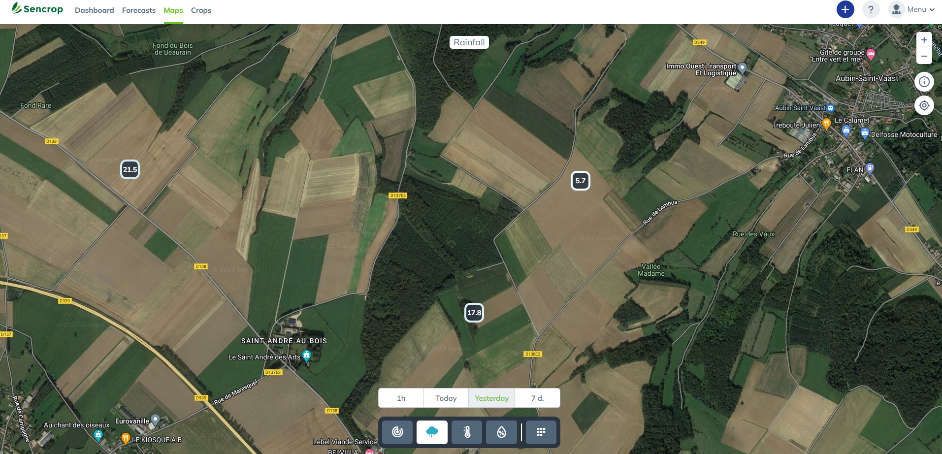
Furthermore, due to spatial and temporal rainfall variability, you should place your rain gauge station as close as possible to where you want to obtain data. Indeed, there may be significant differences in rainfall between your farm and more distant plots.
Differences in rainfall recorded by Sencrop over one day
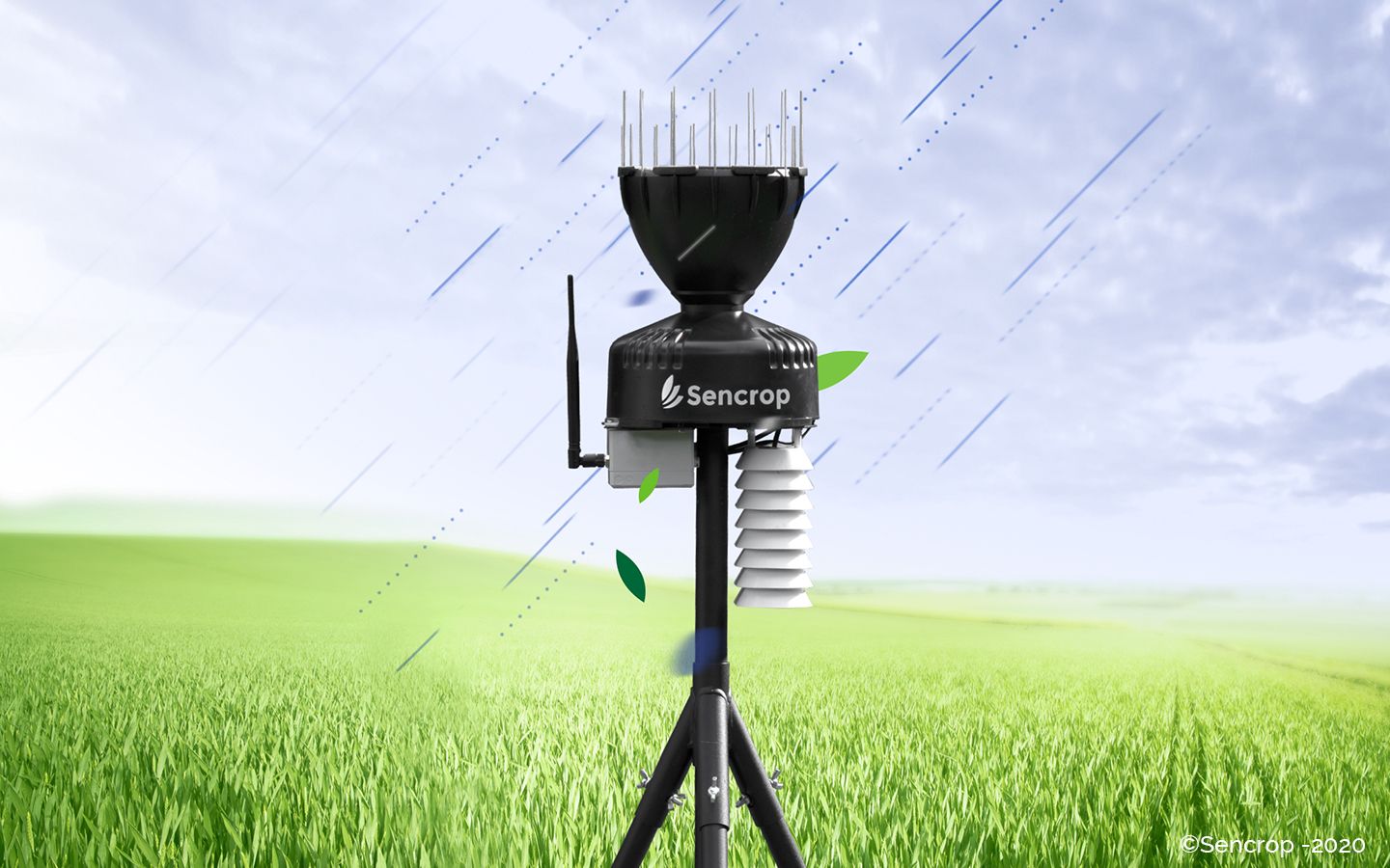
Wind can also distort rainfall results depending on the shape of the rain gauge. As with the building shown above, a rain gauge can cause a disturbance in the airflow and form an air net over the collector, preventing water from entering. Therefore, choosing a rain gauge with an aerodynamic profile is crucial to obtain a result the closest to reality as possible. Sencrop’s connected rain gauge, the Raincrop, has been designed to minimise the impact of wind on rain collection.
Beware of comparison with weather websites!
Sencrop is one of many players concerned with calculating local rainfall measurements. The national services of many countries are studying these issues in detail in order to be able to prevent flooding phenomena more and more quickly and accurately. However, these national services are not agronomic but serve a national need, such as providing reliable data for an airport.
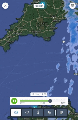
Rainfall data can come from radar data or connected rain gauges. However, the study of different types of rainfall on several pieces of equipment has shown that radar data, if not corrected by field surveys, have deviations of 28% over medium distances (0-50 km) and 54% over long distances (100-150 km). Having good spatial and temporal resolution is crucial to obtain data close to what is happening in the fields (in the case of the Mediterranean climate, it is recommended to have a temporal resolution of 3 to 6 min and a spatial resolution of 2 to 4 km). There is, therefore, a significant variation between weather forecasts and data collected in the field. Rain is not an exact science!
Sencrop Rain Radar
Knowing the source of the data matters when comparing measurements with local measurements.
So if you want to compare your Raincrop measurements with other local measurements:
Take into account the measurement method used and its degree of reliability
Be aware that rain has a high spatial and temporal variability and that the weather in your field may differ significantly from the weather on your farm or in your village/city
📢
We hear from customers that there are significant differences between the two sides of a village. All it takes is a river or a forest bringing its humidity or a human construction, such as a railway track creating a break in a forest, or a wind corridor, to observe microclimates.
Now, you understand the many elements impacting drops of water from the cloud to your fields and the importance of a local weather station.
Ultra-local weather is finally available to those who need it most!
Measure ultra-local rainfall with precision
The Raincrop connected rain gauge is an agro-meteorological station that informs you in real-time of the climatic conditions in your crops.
Twice a month, news on agricultural weather, ag-tech, and Sencrop innovations to enlighten you and help you make better decisions every day. Subscribe now! 👇